Providing Professional Surveying and Land Development Services
Serving all of California and Nevada.
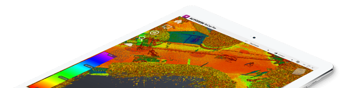
A survey, often used by architects or engineers, locating both man-made and natural features. Such features include buildings, improvements, fences, trees, walkways, streams, contours, etc. Some of the technology used by our field crews are...
- Robotic Instruments
- Reflectorless laser technology
- GPS
- 3D Laser Scanning
- UAV scanning
Learn more about how Muir Consulting, Inc. performs Topographic Surveys
Muir Consulting, Inc. specializes in Environmental Surveys. We provide a "turn key" product for state required electronic submittal, performed to GeoTracker specifications if required.
Environmental Surveys are surveys that locate the following...
- Monitoring Wells
- Soil Bores
- Vapor Wells
- And other monitoring devices
Learn more about how Muir Consulting, Inc. performs Environmental Surveys
As an exemption to the Subdivision Map Act, lot lines can be adjusted and parcels can be merged, as long as no new lots are created. Local agencies determine the process that the owner must go through, always requiring the services of a licensed land surveyor.
How Muir Consulting, Inc. can help when a Lot Line Adjustment/Parcel Merger is needed...
- Honoring the Setback
- Resolving the Conflict
- Recording the Survey
Learn more about how Muir Consulting, Inc. performs Lot Line Adjustments and Parcel Mergers
There are many ways that Muir Consulting, Inc. can help you with your Land Surveying needs.
Here are some of the other Services that we perform...
- Boundary Survey
- ALTA/NSPS Land Title Survey
- Subdivision Mapping
- Condominium Mapping
- Easements / Right-of-Ways
- Elevation Certificates
- Infrastructure Monitoring
Learn more about Muir Consulting, Inc. Services
Call Us!
209-845-8630
Or Send Us A Message
ECONOMICAL AND EFFICIENT
Our methods and procedures for surveying and mapping enable us to be on the forefront of production.